Facebook

30 April 2014

Going For A Walk: Rotoroa Island {Or Why Weren't We Invited To The Wedding?}


Rotoroa Island was another one of those places I really wanted to visit while we were cruising in New Zealand this summer. I had done some research on it previously and was really intrigued by its history as a Salvation Army alcohol treatment center (along with the neighboring island Pakatoa). The Salvation Army have since closed their facilities on both Rotoroa and Pakatoa Islands. Pakatoa was turned into a resort complex and I believe it is still for sale if you have a lot of cash on hand. Rotoroa has been leased from the Salvation Army and transformed into a conservation island where you can learn about the history of the Sallie's operations on the island, as well as see the efforts that are going into restoring the native flora and fauna. They have a regular ferry service, so if you don't have your own boat, you can still visit and enjoy the island.

When you land on the island, this is the first sign you see. There is a NZ$5 per person visit landing fee to help contribute to the operating costs of the island. One of us really balked at paying to visit the island, especially since there are so many other islands you can visit for free in the Hauraki Gulf. His name might begin with the letter "S". And while I admire his frugal approach to cruising (every penny counts in the cruising kitty!), I really wanted to see the island, so we did. I figured for the price of a bottle of cheap wine, it was worth it to see where people who drank way too many bottles of cheap wine were treated.


You can see that they have separate bays for ladies and men. I've seen this on other historic islands. Personally, I think it is a great idea to have separate places for swimming. Less time spent worrying about how you look in your bathing suit and trying to remember the last time you shaved your legs. Unfortunately, nowadays, the beaches are co-ed.

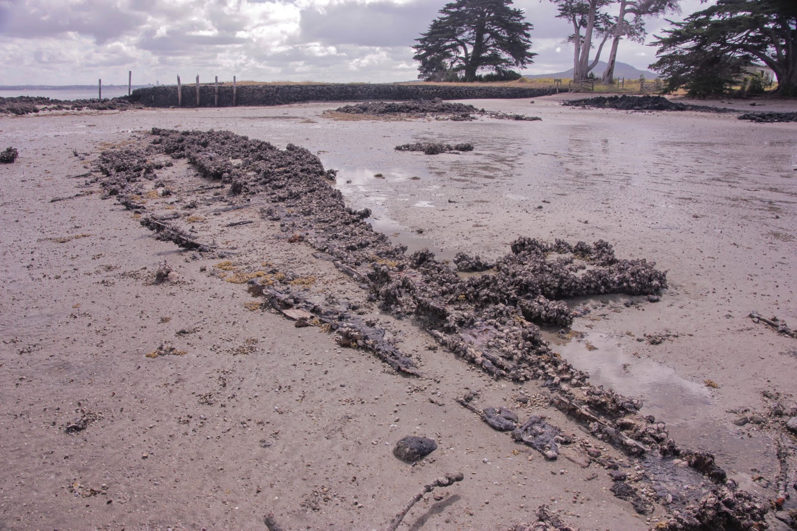
On the wharf there is what looks to be an old run for sheep to be loaded on and off of barges. Sheep make for very handy lawnmowers.


This is the new exhibition center on the island. On the ramp leading up to the entrance are 12 panels reflecting the Salvation Army's "12 Steps to Recovery". This isn't the kind of island where they encourage visiting boaties to start partying and binge drinking. You can drink while you're having your picnic or barbeque on the island, but they ask that you do so in moderation. Inside the exhibition center is the honesty box where you pay your landing fee.

There is a very interesting exhibit on the history of the island inside the center. I liked this old photograph which shows how it used to look back in the day. Although some of the buildings have been preserved, the island looks very different today.


This is one of the old buildings still on the island. You can see some of the restoration plantings on the hillside.


This was the holding cell where they put people to dry out if needed when they first arrived on the island.


The steps up to the chapel.

Which was surprisingly locked. I thought that it might be open so that people could have a look inside and perhaps a quiet moment of meditation, prayer, reflection or day-dreaming.


After checking out the chapel, we wandered over to Ladies Bay where we got to see this bride and groom having their wedding shots. It looks like they had their ceremony on the beach. They lucked out with the weather - nice and sunny for their big day.


While the newlyweds were having their photos taken, it looked like everyone else was at this cottage setting up for the reception. You can see a guy pulling a wagon which looked to be full of food and drink. They have a number of cottages you can rent, as well as a hostel, on the island.


After spying on the newlyweds and their friends, we walked up to the cemetery.


You can see the graves of former staff and clients and take in some great views of the neighboring islands.


Next we climbed up to the top of North Tower where we saw the bride and groom again having another photo opp. By this point, I was beginning to feel like we were quite good friends and thought we were going to be invited to the reception. The bride looked so pretty - nicely done hair and make-up and her dress was spotless. Me on the other hand - frizzy and unwashed hair, sun cream smeared all over my face and pretty mangy looking clothes. Perhaps that's why we didn't get invited down to raise a glass of bubbles and toast the new Mr. and Mrs.


We headed back down the hill to make our way back to the boat and we ran into these folks. Clearly they weren't invited to the wedding either. They definitely had that look of cruisers about them - the backpacks and shoes that you can wear both in and out of the water was kind of a dead giveaway.

And this is how we ended the day. Some Snappy Snapper Chowder made with the snapper Scott caught earlier that day. You can find the recipe here.


Walk on Wednesday, 19 March, 2014

Linked up to Travel Tuesday with Bonnie, Melanie & Tina. 

28 April 2014

A Tale Of Five Anchorages


Moving anchorages in the middle of the night. Not my idea of fun.

 
Tuesday & Wednesday, 18-19 March 2014
 

My mom isn't a sailor and I'm pretty sure whenever we write about things like nautical miles, wind speed and direction, chop, swell and anchoring, she kind of glosses over those parts of the posts and skips ahead to the pretty pictures. So, I thought it might be helpful to talk a little bit about how we pick spots to anchor by running through the five anchorages, on four different islands, we anchored at over the course of two day. Yep, that's right - five anchorages, four island, two days. Trust me, that wasn't the plan. Especially as it involved shifting anchorages at 2:00 am. In the dark. Without any coffee. In my pajamas. Good times.

We use the Spot X Cruising New Zealand guide to help us pick anchorages. It tells you all sorts of useful information - like what wind direction and swell an anchorage is exposed to. These are two critical pieces of information. You do not want to be anchored someplace where the wind could push you onto the lee shore. That is unless you have some awesome boat insurance, you're wearing some sort of padding (like those sumo wrestling suits you see) and the lee shore is a soft, sandy beach covered in marshmallows which cushions your boat as it softly washes ashore. That scenario isn't likely to happen, so knowing the forecasted wind direction and what wind your anchorage is exposed to is crucial. Assuming your weather forecast is accurate. Because they always are.

The other helpful bits of information our cruising guide gives us are what kind of weather the anchorage is suitable for and the bottom type and holding. You wouldn't want to anchor in a place that is only suitable for fair weather if you're in gale force conditions. And you wouldn't want to anchor in a place with poor holding. If you do either of these, you are in for a sleepless night. 

So here is the run down of our five anchorages and what we experienced.

Anchorage #1 - Crater Bay, Browns Island (36°48’S 174°57’E)

Here is what our cruising guide has to say about Crater Bay to give you an idea of the type of information we look at when deciding where to anchor:

Suitable: Fair weather
Exposed to Wind: N, NE, E, W, NW
Exposed to Swell: N, NE, E, W, NW

Shallow bay, but well sheltered in anything from southerly quarter. Reef runs out from eastern end of island to lighted beacon, otherwise clear entry into middle of bay approx. 100m off beach in 2m. Moderate holding. Well sheltered bay with nice beach. Track runs from west end of beach up the cliff. Great views from extinct volcano summit and wonderful cone.


The "fair weather" wasn't a problem for us as it was a settled morning with very little wind and we were only planning on spending a few hours on Browns Island going for a walk. So wind and swell exposure weren't things we were too concerned with when we anchored. You also need to make sure you know what the draft of your keel is and how deep the water is that you're anchoring in so that you don't touch bottom. Touching bottom is generally not a good idea. That is unless the bottom is comprised of soft marshmallows. Again, that scenario rarely happens. Crater Bay is shallow and although we only draw 1.6m, we anchored a bit further out than the X marked in the cruising guide. All went well and we had a lovely little walk.

Anchorage #2 - Te Matuka Bay, Waiheke Island (36°50’S 175°7’E)

After our walk on Browns Island, we headed across the Tamaki Strait and over to Te Matuka Bay on the southern side of Waikehe Island to anchor for the night. The forecast was for light winds from the north. Te Matuka Bay is exposed to winds and swells from the SE, S and SW. So, we should have been fine. And we would have been if the forecast bore any resemblance to the reality that night. As you would expect, the winds turned to the south. And not just a light wind, but a big stonking, mean, out-to-get-you kind of wind. The kind that generated big waves which slammed into the side of our boat and made everything very roly-poly. It was so bad that at 2:00 am, we decided to move anchorages. 

PFDs on. Headlamps on. Nav lights on. Engine on. Anchor up. And we were off to anchorage number 3... 

Anchorage #3 - Te Kawau Bay, Ponui Island (36°50’S 175°10’E)

It makes such a difference to have some local knowledge when you're shifting anchorages in the middle of the night. Not that we're really locals or that experienced in sailing in the Hauraki Gulf. But we have sailed around Waiheke and Ponui Islands many times, so we felt a bit more comfortable sailing in the dark from one anchorage to the other then we would have been if it was a new area to us. 

Our new anchorage, Te Kakau Bay, is exposed to winds from the northerly quarter. If the forecast had been correct, this would have been a problem. In the real world, this was just fine as the winds were coming from the south. Fortunately, no one else was in the anchorage when we dropped the hook in the middle of the night. Peace at last.

Anchorage #4 - Southwest Bay, Rotoroa Island (36°49’S 175°11’E)

The next morning, we decided to head over to the neighboring Rotoroa Island to explore. It is just a hop, skip and a jump between Ponui and Rotoroa Islands, so it was a short trip to our next anchorage, Southwest Bay. Although Southwest Bay is exposed to winds from the southerly quarter, they had pretty much died out and we had another settled morning. It seems to happen a lot like that here - settled mornings and windy nights. 

Easy anchoring in good holding in mud. Yes, if you're a cruiser, you become quite interested in what the sea bottom is made up of - whether it is mud, shell, shingle, sand, marshmallows etc. We have a great anchor and it seems happy staying put in whatever we drop it in. After our walk on Rotoroa Island, we were in a bit of a quandry - should we stay anchored in Southwest Bay for the night or move? We moved.

Anchorage #5 - Chamberlain's Bay, Ponui Island (36°50’S 175°11’E)

After doing a spot of fishing in Ruthe Passage, rather than go back to Southwest Bay, we decided to anchor for the night in Chamberlain's Bay. Winds were predicted to be from the southerly quarter and Chamberlain's Bay is on the north side of Ponui Island and well protected from the south. The ideal thing about Chamberlain's Bay is that if the winds do shift, it is a straight shot back over to Southwest Bay should you have to move in the middle of the night. Thankfully, this time, reality and the forecast were the same.

Overall

Total nautical miles = 24
Number of anchorages = 5
Number of islands anchored at = 4
Number of unplanned night hours = .75

And now for a shameless plug for The Monkey's Fist. Do you have a post you want to share on what makes a great anchorage? Come on, you know you want to share! Head on over and add a link to your post in the comments section on the topic in development page here. It's easy and it's painless. Trust me.

Sourced from LINZ. Crown Copyright reserved.

25 April 2014

Cyclones Suck

Red sky in the morning at Westhaven Marina. Cyclone Lusi is on her way.
I have to say that I never really paid much attention to cyclones until this summer. Back in my working days, I knew they happened and I knew they brought bad weather to New Zealand and could really muck up your weekend plans. But until we started cruising full-time this summer, I didn't really appreciate how much cyclones suck. And it isn't just the high winds, the crashing waves and the lack of sleep that they cause. It is the fact that they can mess with your social life and your cruising plans that really gets me. 

We had been having a great time up in Northland but knew we needed to get back Auckland in time for the Classic Yacht Regatta that Scott was racing in on the weekend. He was really looking forward to the racing, the rum and catching up with everyone. Poor thing. It got canceled due to Cyclone Lusi. And of course, we got into Auckland before we found out it was canceled. If only we had a magical weather prediction machine - we could have stayed up north. (And we could make a lot of money selling everyone accurate weather forecasts.) Instead, we spent a week in Auckland. And while we really like Auckland, the whole point of this summer was to be out cruising and explore new parts of New Zealand. So disappointing. Damn you wind, damn you.

If you want to learn more about what two people do when a cyclone gets in their way, read on. 


This is what Scott wanted to be doing before Cyclone Lusi had her way - seeing the classic yachts racing out in the Hauraki Gulf. 

Monday, 10 March 2014

We left Kawau Island around 9:30 am after resting up from our night passage from Whangaroa. A pleasant sail with an unsuccessful fishing stop in the Motihue Channel. Anchor down in good old Islington Bay around 6:00 pm and the usual spaghetti dinner that we've come to know and love so much this summer. I really need some new recipes.

Tuesday, 11 March 2014

We got into Westhaven Marina around lunchtime and booked in for a week. You get a discount if you stay for a week, so we figured it was worth it to get to Auckland a couple of days before the big regatta to enjoy showers, internet connection, the ability to charge our computers and easy access to the grocery store. Later that evening, once we were all settled in, they canceled the regatta due to Cyclone Lusi. Scott was so disappointed. And all we could think of was that if only we had known this would happen, we could have stayed up in Northland, done some more exploring up there and found a new place to hide out from ex-cyclones, rather than our usual Westhaven Marina experience.

We decided to salvage what was left of the day by going to see All Is Lost with some free movie vouchers we had. Scott had been wanting to see this movie for ages. I've never quite figured out how film releases work in New Zealand. Any movie that I don't want to see usually ends up being released only a few weeks after it comes out in the States. But if there is a movie you do want to see, chances are it won't be released here or it will be released months and months after it has come out on DVD and/or has finished screening in the rest of the world. We managed to see All Is Lost on the last day it was screening here (months and months after it was first released in the States). And, boy what a waste of time that was. For the second time that day, Scott was majorly disappointed. There is nothing worse then waiting to see a movie only to wish you hadn't. Oh well, at least it was free.

Wednesday, 12 March 2014 

We pretty much did nothing other than hang about in Auckland and eat pizza. Scott wanted to go for a sail before Lusi hit, but to be honest, I was just too darn lazy. 

Thursday, 13 March 2014 

Scott told me that it was time for me to stop being a slug as there would be plenty of slug-like days ahead with Lusi coming. So we went out for a sail in the Waitemata Harbour and did some sail training. I got to practice helming while we gybed and tacked, tried to get the boat to obey while going astern, anchored under sail and sailed off the anchor. When we got back to the marina, Scott went out for the Thursday night rum races where he got to sail with people who actually know how to do the stuff that I was practicing earlier in the day. While he was racing, I reverted back to my slug-like state and read. I should have been reading a book about how to sail, but I read a novel instead.

Friday & Saturday, 14-15 March 2014

Boring, boring, boring. Hanging around the boat, listening to the wind howl, not being able to sleep and knowing that you're stuck someplace you don't want to be is boring. That is about all I can say about these couple of days. Well, we did have french toast at the Sitting Duck Cafe in Westhaven one morning. That broke the monotony. Talking about the grilled bananas, the creme fraiche and the rhubarb compote they use killed a couple of hours. It was delicious. 

Scott has reminded me that we did have some drama during this period. I had managed to completely block it out of my mind, probably because I might have been responsible. As you can imagine, it was raining cats and dogs. I stupidly went to the computer room with the computer in my backpack. When I got there it did weird things. Maybe it had something to do with the fact that it got totally soaked on the way to the computer room? We have this nifty dry bag backpack that you can put stuff in to keep it dry. Why didn't I use it? Who knows. I must have been just too excited to be able to have internet access. It was a bit a of a fiasco but eventually it started working again after drying out and some sort of magical restore process Scott did. I was impressed, especially as his usual approach to dealing with computer issues is to press on the keys super hard so that the machine really feels your anger and frustration and decides to comply with your wishes. Because that always works. The good news is that, in this case, the computer actually started working again. I've decided to block this back out of my memory. There were some dark hours I would like to forget. Let's not talk about this again.

Sunday, 16 March 2014

This was a great day - I got to spend a few hours at a friend's house pretending I lived on land! She picked me up in her car (not her dinghy), drove me to the supermarket where I didn't have to worry about how I would carry everything back to the boat in my backpack, let me use her washing machine without asking for coins and we ate real food that didn't resemble anything like the pasta dishes I keep making on the boat. Fantastic! I have no idea what Scott did but I'm pretty sure my day was better.

Monday, 17 March 2014

We had to see a guy about a thing so we stuck around Auckland and did some errands. And then we went on a short sail in the afternoon, followed by pizza at our favorite place, Sal's. They import the cheese from Wisconsin. If you haven't been before, there is a reason to go - Wisconsin cheese. And then we re-provisioned at the grocery store to get ready for our great escape the next day. More on the thing with the guy later. 

Overall

Total nautical miles = 50 
Number of free loads of laundry = 1
Number of times we ate Sal's pizza = 2
Number of sleepless night thanks to Lusi = 2

23 April 2014

Our Boat Has A Cameo In A Sailing Video In The Hauraki Gulf

I thought I would take a break from writing a blog post today and instead share with you a really cool video about sailing from Whitianga to Auckland via some of the islands in the Hauraki Gulf marine park. We met the guy who made it, Marko, up in Great Mercury Island and had a great evening with him and some of the other folks up there. The kind of evening where taking some ibuprofen the next morning seems like a really good idea. Marko moved from Slovenia to New Zealand and is now making his way around the world crewing for other folks.

You can check out his video here and if you look closely at the beginning of the video, you can see our boat Rainbow's End has a cameo appearance. How cool is that!


Look for this boat around the 0:15 mark in the video.

21 April 2014

Sailing In The Dark & Eating Lots Of Cookies

Sunrise as we make our way out of Whangaroa Harbour to head down south.
Saturday & Sunday, 8-9 March 2014
 
While Scott has done a number of overnight passages cruising and racing in Europe, my experience with sailing in the dark has been zilch until this summer. Since then we've had a few early morning departures and a few late night anchorings so I've logged a few hours of night sailing under my belt now, but as Scott kept pointing out what I experienced was nothing like sailing throughout the entire night. He absolutely loves it - especially seeing the stars, the solitude and occasionally phosphorescence glowing alongside the boat. He is nothing if not a consummate salesman and brainwasher - how else would have he gotten me to get rid of almost all of my stuff and move onto a 26' sailboat? So when he suggested we sail through the night on our way back down from Whangaroa, somehow I found myself saying yes. 

We hadn't originally planned to do a night sail. We had wanted to anchor in Tutukaka for the night. It is supposed to be a really neat anchorage, plus it is just fun to say Tutukaka, so I was looking forward to seeing it. We got an early start, leaving Whangaroa at 7:00 am as the sun was coming up, but we didn't make it past Cape Brett until 3:30 pm so there was no way we would be able to get into Tutukaka before sunset. At at this time of year, the sun was setting earlier and earlier which was really cutting down on our daylight sailing hours. Scott cleverly said, "You don't really want to try to anchor in Tutukaka during the dark do you? Look the book says that it has a narrow entrance with rocks on either side. It might be dangerous. Why don't we just carry on sailing to Kawau Island?" It was genius on his part using words like "danger", "rocks" and "narrow entrance" because suddenly sailing in the dark to Kawau seemed like a really sensible option. So we did.

The sky was really dark when the sun set, with only a third of the moon shining and lots of clouds obscuring it most of the time. It was pretty spooky. And a bit scary (well for me, not Scott). But if you have a PFD, a tether, a headlamp, a chartplotter and cookies, you feel somewhat prepared even if you can barely see anything. At first it was just us out there, so there was nothing to see. No lights is generally a good thing. Well, that is except for those things that can hit your boat which don't have lights, like whales and shipping containers. But I made a conscious effort not to think about those things. I've got this great technique - every time I think of something scary, I eat a cookie. Completely distracts me from what I was originally thinking of. Of course, if we do many more of these night passages, I'm probably going to get really fat.

We decided to do two hour shifts. We don't have any fancy stuff on our boat, so you have to hand steer the boat during the entire shift. Doing much more than two hours without a break at night was probably going to be enough for me. Two hour shifts obviously wouldn't work for a longer passage with just the two of us, but for this passage it seemed sensible. Plus, let's be honest, with a total newbie like me at the tiller, in the dark, constantly eating cookies to avoid thinking about whales and containers, it wasn't like Scott was really going to get any sleep anyway during the night. 

Bless him, he tried to sleep. But not to worry, I woke him up when I saw some lights coming towards us. When I first saw them, I went through my mental checklist. Whales and containers don't have lights so that wasn't it. After eating a cookie, I thought about what navigation lights on other sailboats and launches look like - red and green like a Christmas tree. These lights didn't look anything like that. They were white. I ate another cookie. Then I started counting the number of lights but I lost track. They kept getting closer and I realized it was a really big boat. I ate another cookie. Then I remembered that there are these types of boats that containers fall off called freighters. So I ate another cookie. And then I woke Scott up to come have a look. He came up top, looked around and said, "Looks like we're at Marsden Point. See all those freighters?" He seemed pretty blase about it so I had another cookie and carried on. Fortunately, my shift ended soon after that and I scurried down below clutching the bag of cookies.

It was good timing for our change of shifts because I really don't think I would have been that calm sailing through the shipping traffic going in and out of the port. Scott was fine with it and didn't seem to require any cookies. Which was good, because we were quickly running out of them. By the time Scott called me up for my next shift, we had made it through the port and were back sailing in the dark. We did a little handover, I tethered myself in and Scott went back down below to try to sleep. 

During this shift there was a whole new set of lights to worry about - the kind that tell you you're going to run into reefs and islands and those types of things. Fortunately, I had studied the paper charts and was starting to feel a bit more comfortable using our chart plotter so I managed to make it through this shift without waking Scott up. I thought about it, believe me, I thought about it. But I didn't because I thought he might ask me where the cookies were and they were all gone by this point. So I carried on. I did have a little moment where I really freaked out when Sail Rock in the Hen and Chickens Islands seemed to pop out of nowhere. And even though the chartplotter and common sense said I could sail quite close to it, I made a big detour around it. I probably added 30 minutes onto our sail, but I figured my sanity and Scott getting some shuteye were worth the extra time. When Scott came up for his shift and looked at my track on the chartplotter, he did roll his eyes a bit, but I think he knew better than to say anything.

Finally, the sun started to come up and I realized that I had made it through my first overnight passage without hitting anything. I did have a tummy ache from all of those cookies, but it seemed like a small price to pay. We had the anchor down in Two House Bay in Kawau at 1:45 pm and celebrated with some pretzels and coke. Because of course, what you need after a night of eating cookies, is some more sugar in the form of soda pop.

The sun comes up for the second time on this passage. Seeing Great Barrier Island off to port was reassuring - it meant we were going in the right direction.

And finally at anchor at Two House Bay, Kawau Island with the sun fully overhead. No whales, containers or freighters to worry about.

Overall

Total nautical miles = 119
Overall number of hours = 30 hours 45 minutes
Number of hours night sailing = 11
Number of times I woke Scott up = 1
Number of cookies I ate = enough to get a tummy ache

Sourced from LINZ. Crown Copyright reserved
Sourced from LINZ. Crown Copyright reserved.

18 April 2014

Going For A Walk: Browns Island {Or Don't Worry, The Volcano Is Extinct}

Brown's Island - one of the many volcanoes scattered around Auckland.

Browns Island has been on my list of "really, really want to visit before we leave New Zealand" ever since I started doing research on islands in the Hauraki Gulf last year. It has everything you could want in an island - archaeological sites, a volcano and great views. We finally made it there and it was well worth the visit! If you want to know more about the island, you can read our original post here.


We landed our dinghy on the beach near Crater Bay. It is a fair weather anchorage so best to wait for a settled day for your visit to the island.
There is a clearly marked path with access to the island via these stairs. Don't worry, there aren't too many of them.
Once you get up the stairs you can see Auckland off in the distance, as well as some of the archaeological remains on the island.
We headed up the path to the top of the volcanic cone.
And this is what it looks like. Doesn't look like it is going to erupt again anytime soon.
After walking around the cone, we tramped through the tall grass over to the other beach to check out the remains of the old ferry boats which were abandoned there. You should time your visit for low tide so you can check them out.
Another one of the old ferries.
I have no idea what this is.

Some of the best views of the islands in the inner Hauraki Gulf and of Auckland can be had from Browns Island. 

Walk took place on Tuesday, 18 March 2014

16 April 2014

$6.50 For A Loaf Of Bread - I Think They Saw Us Coming


In order to make this full-time cruising thing work, we really need to live frugally and that means paying close attention to each and every penny we have and spending them carefully. I have a spreadsheet where I track everything we spend to a pretty detailed level, including the price of bread. Usually a loaf of bread in New Zealand costs us around NZ$3.50 - we have a few favorite brands and we typically buy whichever one is on sale. We've even purchased bread for as little as NZ$2.20, but to be honest the money we saved wasn't worth it. It tasted like a combination of cardboard and pencil shavings. So not yum. I'm pretty sure any nutritional value was overshadowed by the very long list of chemicals listed on the side of the bag. We won't be buying that brand again. 

Once you get out of larger cities and towns and into more provincial areas and remote anchorages on islands, you do expect to pay a bit more for bread. We've gone up to NZ$5.00 and sometimes even NZ$5.50. When we were in Whangaroa, we were a bit desperate for bread, so we hit the local general store. You don't often find price tags in these types of places and I made the mistake of not asking how much the bread cost before I carried it up to the counter. I assumed it would be in the NZ$5.00 range, so when the lady asked for NZ$6.50, I almost fell over. She didn't even smile or say "please" or do anything at all to take the sting away. I think she had heard our American accents when we came in, noted the look of cruisers we had about us and thought to herself, "Yep, they're foreigners. They'll pay $6.50 for this loaf of bread." And we did. I really need to get an oven on our next boat so I can bake our own bread.

Here is the latest on our adventures up in Northland. And, yes, the menu featured bread.

Thursday, 6 March 2014

Waking up at our anchorage in the Bay of Islands, the winds were still forecast to be high with moderate seas, so at first we were going to hold off on an early departure, but in the end we decided to just get going. We left the Bay of Islands around 7:00 am and were treated to an incredible send-off by the local dolphins. Once you're had your coffee and are ready to go, you kind of lose patience waiting around for the weather to break. Fortunately, it was a good call on our part and the weather was fine. We made our way up the coast and then stopped for a few hours at the Cavalli Islands, had lunch and waited for the tides to change in order to make things easier to get into Whangaroa Harbour.


View from where we anchored at North Bay, Motukawanui Island in the Cavallis.
The Cavalli Islands are a small group of islands near Whangaroa. The Greenpeace ship, the Rainbow Warrior, was scuttled in here 1987 and is a popular dive attraction. The Rainbow Warrior had been protesting the French government's nuclear testing in French Polynesia and was sunk by the French while anchored in New Zealand. Needless to say, this created a bit of a stir in New Zealand. Would you sneak into someone's garage and let air out of their tires because you don't like the fact that they don't agree with your politics? Of course, you wouldn't. Well imagine if a foreign government came into your waters and decided to start sinking ships. I don't think you would be too happy.


The aptly named Flat Island, which we saw on route to Whangaroa.
After lazing around in the Cavalli Islands, we pulled up the hook around 4:00 pm and headed off for Whangaroa, anchoring around 6:00 pm in Rere Bay. Whangaroa is someplace that Scott had really wanted to get to. We had been hammered by the weather all summer and were beginning to think we would never get that far north. But we finally did and it was definitely worth it. Some of the most stunning scenery in an anchorage that I have ever seen in New Zealand.  

Rere Bay, Whangaroa Harbour.

Friday, 7 March 2014 

The next day, we went for a little tour of the various bays in Whangaroa Harbour before anchoring near the wharf. Whangaroa is a great harbor with a number of bays to choose from, although I have to say that the Rere Bay and the bay next to it are the prettiest of the bunch. If you want to explore Whangaroa town, anchoring near the wharf is probably your best bet. You can leave you dinghy on the beach and walk along the water into the main center. Alternatively, if you just need to make a quick stop, you can tie up to the public dock at the marina for an hour and they'll even let you use their showers. Water is a bit hard to come by - you can't get any water at the public wharf or the public dock at the marina. Fortunately, we still had plenty of reserves so it wasn't an issue for us. But it was a good reminder to me that you just can't assume you can easily get water in every town, especially during a drought.


View of the Whangaroa marina
Although we didn't need water, we did need some bread and to find a place to get rid of some of our garbage and recycling. So we walked down the road carrying our plastic bags and found a place to deposit it near the Whangaroa Sport Fishing Club. Then we headed to the general store, forked over NZ$6.50 for the now infamous loaf of bread and then headed over to the local pub to drown our sorrows about the cost of bread. For the record, a handle of beer at the local pub is about the same price as they're selling bread for at the general store. I think, as a general rule of thumb, a loaf of bread should always cost a lot less than a beer. Whangaroa is the home of big game fishing and the pub has lots of cool looking fish mounted on all of the walls. 


Pub at the Marlin Hotel in Whangaroa
We had planned to anchor overnight near the public wharf but the winds started kicking up so we decided to move to a more protected anchorage for the night. We anchored at Waitepipi Bay (right next to Rere Bay) and not long after we had dropped the hook a couple came up in their dinghy and said that they had seen us back at Mansion House Bay in Kawau and again at Urquhart's Bay. Maybe they just think the little seahorse on the back of our boat is adorable and they keep following us around just to get a glimpse of it. 

After anchoring, it was an early night and, of course, dinner featured grilled cheese made with our newly purchased bread.


One of the previous owners painted this cute little seahorse on. It looks like they painted on the boat's name and former home (Waiheke Island) with leftover anti-foul paint. Very frugal and clever!

Overall

Total nautical miles = 45
New price point for bread = NZ$6.50 
Number of beers we had at the Marlin Hotel pub = 4
Cost of a beer at the Marlin Hotel pub = about the same as a loaf of bread


Sourced from LINZ. Crown Copyright reserved.

Thanks for stopping by our blog - we love it when people come visit! We're also on Facebook - pop by and say hi!

14 April 2014

Is It Dolphin Snot Or Dolphin Spit?


Is the spray you see on the camera lens dolphin snot or dolphin spit?

I'm hoping you can settle a little argument Scott and I have been having. When the dolphin pictured above was swimming alongside our boat in the Bay of Islands, it sprayed us with something. I think it was dolphin spit and Scott thinks it was dolphin snot. Scott's theory is that because the liquid in question came out of the dolphin's blowhole, it has to be snot. But I would much prefer to think the dolphin spit on us - it seems marginally better than having a dolphin blow his nose all over you. Has this ever happened to you and was it snot or spit?

This dolphin was one of very large group that came up and started swimming and playing around our boat as we were leaving the Bay of Islands. There must have been at least 30 of them and I even saw a little baby dolphin among them. It was a fantastic send-off and the most amazing dolphin encounter we have had. They were incredibly close to our boat and at times we couldn't move the rudder as the dolphins were swimming right up against it. We were both jumping up and down with excitement and Scott was madly trying to capture all the action with his camera. And then just like that, it was over and they all turned and headed off in another direction. We hadn't seen too many dolphins this year and especially not up this close and personal - it was incredible experience that I won't soon forget. 

Here is the rest of the scoop on our time up in the Bay of Islands. We've chartered up there previously (which you can read about here and here), but we focused more on sailing on those trips. This time we got a chance to do more exploring of the islands and had some great walks.

Sunday, 2 March 2014


Paradise Bay, Urupukapuka Island
We left Whangamumu at 9:30 am and anchored at Paradise Bay, Urupukapuka Island in the beautiful Bay of Islands at 1:30 pm. Right after we dropped the hook, the local gang of kingfish came around to pay us a visit. I wonder if kingfish wish they were dolphins as they always seem to "play" around our boat. Except their form of "play" seems to involve smashing into the hull and generally making a nuisance of themselves. Scott tried to get one of them, but they seemed less interested in his lure and more interested in our boat. Eventually they left and we dinghied over to the island and went for a hike. Urupukapuka is probably one of the nicest islands I have been to in New Zealand and they have some fantastic trails. Highly recommended if you are ever out this way! 

We rarely swim in New Zealand as we find the water way too cold, but after our long and sweaty hike, we had a nice swim before heading back to our boat. Strangely, we were the only boat in the anchorage that night which was a pleasant surprise as we're so used to having other boats around, many of whom like to anchor way to close to us for comfort. Unfortunately, the wind kicked up during the night and bay ended up getting quite roly-poly over night, so it wasn't the most restful sleep. You would think I would be used to that by now - I'm not.

Monday, 3 March 2014


Parorenui Bay
The next day we focused on some sail training running through our tacking routine but then the winds got to be too much of a nuisance to practice anything else. So, we took the sails down and headed into Parorenui Bay around lunchtime and anchored there for the night. I needed a shower pretty badly by this point, but I decided that it was too windy and cold to be stripping down and washing up in the cockpit. I'm setting a new standard of personal hygiene and it is getting to be a pretty low one. 

Tuesday, 4 March 2014


Waiwhapuku Bay, Moturua Island
On Tuesday, we planned to do some more sail training, but we were only able to get in a short session of tacking and man overboard drills before we got hit by a squall and decided to call it a day. We anchored at Waiwhapuku Bay, Moturua Island and then went for a nice walk on the island after lunch.

Wednesday, 5 March 2014


Waipiro Bay
It was another wind warning day with gusts of 35+ forecast, so we moved over to Waipiro Bay where we would get better protection. We had planned to head up to Whangaroa, but the weather kind of ruled that out for us. So instead, we dinghied over to the mainland to try to find the trail to Whangamumu where we had anchored a couple of nights ago. We walked along the road for awhile but eventually gave up and headed back. If you've ever walked along roads in New Zealand, you'll know that sidewalks are rare, there are often blind curves and you always wonder if a car is going to hit you. It was one of those days where the walk along the road didn't seem worth it.  So instead, we headed back to the boat and got ready for an early start the next day to continue our adventures up north. 

Thursday, 6 March 2014

Dolphins, dolphins, dolphins! This was the day of the great dolphin send-off as we left the Bay of Islands and as if the up close and personal encounter wasn't enough, we also got to see a group of dolphins a bit further out once we left the Bay of Islands and started heading up north. I think it was the dolphins way of trying to make it up to us for the bad weather we had while visiting their playground.  

Overall

Total nautical miles = 27
Number of dolphins playing around our boat = 30+ (plus another group later on!)
Number of walks = 3
Number of days impacted by the wind = 3 (damn you wind, damn you!)

Thanks for stopping by our blog - we love it when people come visit! We're also on Facebook - pop by and say hi! 


Chart of Bay of Islands showing the bays where we anchored. Sourced from LINZ. Crown Copyright reserved.